
Greenhouse Gas removal in the Iron and Steel Industry Sep 1, 2017 - Jun 30, 2022
This is a GGR Topic-specific proposal
Up to 200 billion tonnes of slag may be produced over the next century as a by-product of the iron and steel industry, which could theoretically sequester up to 90 to 155 billion tonnes of CO2 through enhanced...
Read More about Greenhouse Gas removal in the Iron and Steel Industry.
Projects (79)
CiRcular Economy: SusTainability Implications and guidING progress Jan 1, 2018 - Dec 31, 2021
Project website: http://cresting.hull.ac.uk/
Historical Map of Hull Nov 1, 2016 - Nov 30, 2017
We request a grant to cover funding for a printed and digital historical map of Hull. This first historical map of this key British port-city will demonstrate Hull’s historic form, scale, development and significance over the centuries. It will be...
Read More about Historical Map of Hull.
Evidence based approach to effect of decommissioning on MPA conservation and ecosystem services Feb 1, 2017 - Jan 31, 2018
Building on existing frameworks, we will develop a Decision Steering Document (DSD) which contains a transparent, defendable and more streamlined procedure for identifying and assessing scientific evidence. The DSD will facilitate decision-making for...
Read More about Evidence based approach to effect of decommissioning on MPA conservation and ecosystem services.
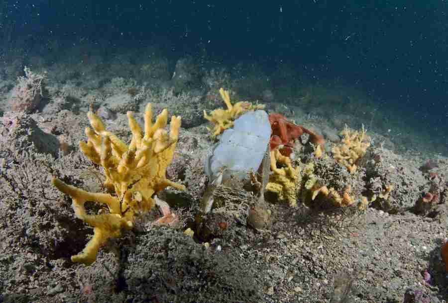
Sublittoral rock indicator: spatial correlation between environmental conditions and biological data Jan 1, 2017 - Jun 1, 2018
The Joint Nature Conservation Committee (JNCC) wish to develop and calibrate the ‘morphological diversity of sponge assemblages plus anthozoan species composition and abundance’ indicator for the monitoring of sublittoral rock. Initial analysis of So...
Read More about Sublittoral rock indicator: spatial correlation between environmental conditions and biological data.
Understanding floods from catchment to coast Jan 1, 2017 - Dec 31, 2017
Runner-Up Award as part of the favourite exhibit at Into the Blue held in Manchester 2016
Neyland marina dredging impact study Jan 1, 2017 - Dec 31, 2017
NEYLAND YACHT HAVEN DREDGING : STATISTICAL ANALYSIS 2004-2016
Analysis of benthic and sediment (particle size parameters) data for the Neyland Yacht Haven dredging project.
spatial analysis of benthic community and sediment parameters for 2016...
Read More about Neyland marina dredging impact study.
Investigation on the origin of the deep mud habitat in Whitsand and Looe Bay MCZ Aug 26, 2016 - Jun 30, 2017
The Whitsand and Looe Bay Marine Conservation Zone (MCZ) was designated, under the Marine and Coastal Access Act (2009) in December 2013, along with 26 other MCZs. Features of Conservation Interest include intertidal rock, a variety of intertidal sof...
Read More about Investigation on the origin of the deep mud habitat in Whitsand and Looe Bay MCZ.
Resource recovery and remediation of alkaline wastes Aug 31, 2014 - Mar 31, 2019
This project addresses environmental problems and potential benefits posed by alkaline waste materials. These are generated in large quantities by many industrial processes around the world. The project will provide fundamental scientific understandi...
Read More about Resource recovery and remediation of alkaline wastes.
Assessment of the BONUS programme Sep 19, 2016 - Mar 17, 2017
Assessment of the BONUS programme impact on relevant policies, innovative industries and macro-regional research
IOF - Development of an international research group in hyperspectral thermal remote sensing of volcanic processes and terrains Dec 1, 2017 - Feb 28, 2022
This project will develop a new international collaboration between a UK-based research team, with expertise in both volcanic processes and Earth Observation Science, the Nordic Volcanological Centre at the University of Iceland (UoI) and the Geologi...
Read More about IOF - Development of an international research group in hyperspectral thermal remote sensing of volcanic processes and terrains.
The Last Ice Age Apr 1, 2018 - Dec 31, 2022
The overarching aim of the project is to enhance knowledge and understanding of the scale, character and significance of the Norwegian natural ice business during the late nineteenth and early twentieth centuries. The overseas trade in ice will be an...
Read More about The Last Ice Age.
Thinking forward through the past: Linking science, social science and the humanities to inform the sustainable reduction of endemic disease in British livestock farming Sep 1, 2018 - Aug 31, 2023
Livestock disease today is a complex, pressing problem that threatens the development of more sustainable, ethical and efficient farming methods. This project will devise a fundamentally new approach to its investigation that advances understandings...
Read More about Thinking forward through the past: Linking science, social science and the humanities to inform the sustainable reduction of endemic disease in British livestock farming.
Shanghai-UK Industrial Challenge programme Innovate UK Feb 1, 2018 - Oct 31, 2021
Green Infrastructure Assets (GIAs) can often be perceived as an unnecessary cost, and something that must be done because of law or planning policy, however there are many business opportunities that GIAs can deliver in terms of cost, time savings, e...
Read More about Shanghai-UK Industrial Challenge programme Innovate UK.
A review of the Environmental Status of the waters of the Tidal Thames. Aug 1, 2017 - Jul 31, 2018
Changes to emission limits, made under the Large Combustion Plant Directive, gave power generation companies the option to ‘opt in’ and install pollution abatement technology or ’opt out’ and close power plants which did not comply with the new emiss...
Read More about A review of the Environmental Status of the waters of the Tidal Thames..
Time of their lives Nov 1, 2013 - Apr 30, 2017
Terms and conditions have been agreed by the Dean
Colonial Science’ and the production of comprehensible territory in Italian Libya Jun 15, 2015 - Dec 31, 2018
As Western commentators scrambled to interpret Libya's part in the ‘Arab spring' of 2011, virtually none recognised the significance of the Italian colonial period in constituting the state they analysed. Now that this state appears to be disintegrat...
Read More about Colonial Science’ and the production of comprehensible territory in Italian Libya.
Global infrastructure public-private partnerships and the geopolitics of city-regions Nov 1, 2015 - Oct 30, 2017
In a context of global austerity and regulatory instability, city-regional authorities in many countries are turning to a new generation of global infrastructure public-private partnerships (GIP3s) in order to leverage private investment for major in...
Read More about Global infrastructure public-private partnerships and the geopolitics of city-regions.
Development of a UAV-mounted Imaging FTIR for real-time monitoring of natural and anthropogenic hazards Jun 30, 2016 - Dec 29, 2017
Rapid, accurate assessment of the source, nature, intensity and extent of natural and anthropogenic hazards is a critical capability in order to effectively respond to the needs of the affected population and environment and to implement an effective...
Read More about Development of a UAV-mounted Imaging FTIR for real-time monitoring of natural and anthropogenic hazards.
Quantitative 3D remote digital compositional and structural characterisation of outcrops Jul 1, 2016 - Apr 30, 2017
This project aims to demonstrate the capability of a new type of field portable remote sensing instrument (the MicroFTS), developed by the applicants as part of a NERC funded project, integrated with a Terrestrial Laser Scanner (TLS), and ultrahigh r...
Read More about Quantitative 3D remote digital compositional and structural characterisation of outcrops.